How to use
- Go to http://coolerkidsontheblock.azurewebsites.net/final/project/index.html
- At the bottom of the left panel you have 3 buttons
-
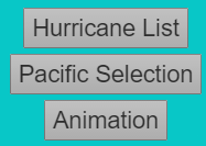
- Use these buttons to navigate through 4 different panels
-

-

-

-

- On the atlantic/pacific panels..
- ..you can show hurricanes by using selectors
-
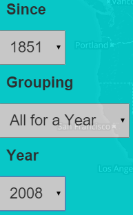
- You should now see hurricanes!
-
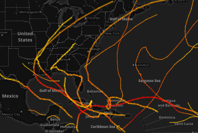
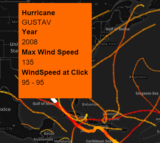
- Hover and click on the Hurricanes for more info
-
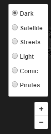
- You can also zoom in/out by using the mouse or click the +/- buttons
-

- choose from many different map styles
-
- Show/hide graphs with the button in the bottom right corner
-

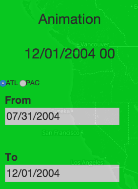
- In the Animation panel you will be presented with two input text fields. The text has to be in the format as shown
- You are capable of choosing which hurricanes will be animated (PAC or ATL) by selecting it above the text fields
-
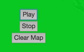
- After inputing the dates you wish to animate over you can press the play button and it will begin the animation
- To stop the animaiton you can hit the stop button and the hurricanes will stop where they are
- Finally to clear the map, press the clear map button and all the hurricanes displayed will disappear
-
Data used
the Atlantic hurricane database (HURDAT2) 1851-2014 and the Northeast and North Central Pacific hurricane database (HURDAT2) 1949-2013 at http://www.nhc.noaa.gov/data/#hurdat
Information on the file format:
http://www.aoml.noaa.gov/hrd/hurdat/hurdat2-format-may2015.pdf
We parsed the data into huge javascript arrays,
which we then accessed and manipulated in order to show
information such as hurricane lines, top 5 or 10, etc
Information on the file format:
http://www.aoml.noaa.gov/hrd/hurdat/hurdat2-format-may2015.pdf
We parsed the data into huge javascript arrays,
which we then accessed and manipulated in order to show
information such as hurricane lines, top 5 or 10, etc
Libraries Used
D3 - http://d3js.org/
Bootstrap - http://getbootstrap.com/
Jquery (mostly UI) - https://jquery.com/
Ajax - https://api.jquery.com/category/ajax/
Leaflet - http://leafletjs.com/
Mapbox(Leaflet uses this) - https://www.mapbox.com/developers/
Bootstrap - http://getbootstrap.com/
Jquery (mostly UI) - https://jquery.com/
Ajax - https://api.jquery.com/category/ajax/
Leaflet - http://leafletjs.com/
Mapbox(Leaflet uses this) - https://www.mapbox.com/developers/
Source Code
https://uofi.box.com/s/iwqdzw2bdk98wzp97w7engyf5s56h5vy
Interesting things found
Found that a lot of atlantic hurricanes originate around the northwest coast of africa
and travel west, curving up by the coast of mexico and then travel along the US Northeast coast
While a lot of pacific hurricanes start west of Mexico and just travel about halfway to Japan before dissipating
When Hurricanes approach a land mass, the hurricanes wind speed decreases drastically and the direction of travel is changed
Team members and their roles
Lukasz
Worked on:
- Setup/Managed website
- Imported/Parsed data
- Drew/Managed Hurricane lines draw on the map
- Setup side panels and handled resizing
Chris
Worked on:
- Content within current hurricanes panel
- Graphs pertaining to currently shown hurricanes
- Setup selectors in pacific/atlantic panels
Steven
Worked on:
- Animation of hurricanes over specified dates
- Animation of markers over lines Drawn on map
- Restructured animation panel to fit program functionality
Youtube video
https://youtu.be/h28fF5InQAI